
Wildfires pose an escalating threat globally, and understanding how vegetation corridors influence ember spread is crucial for protecting communities and ecosystems.
🌿 Understanding the Fire Triangle and Ember Behavior
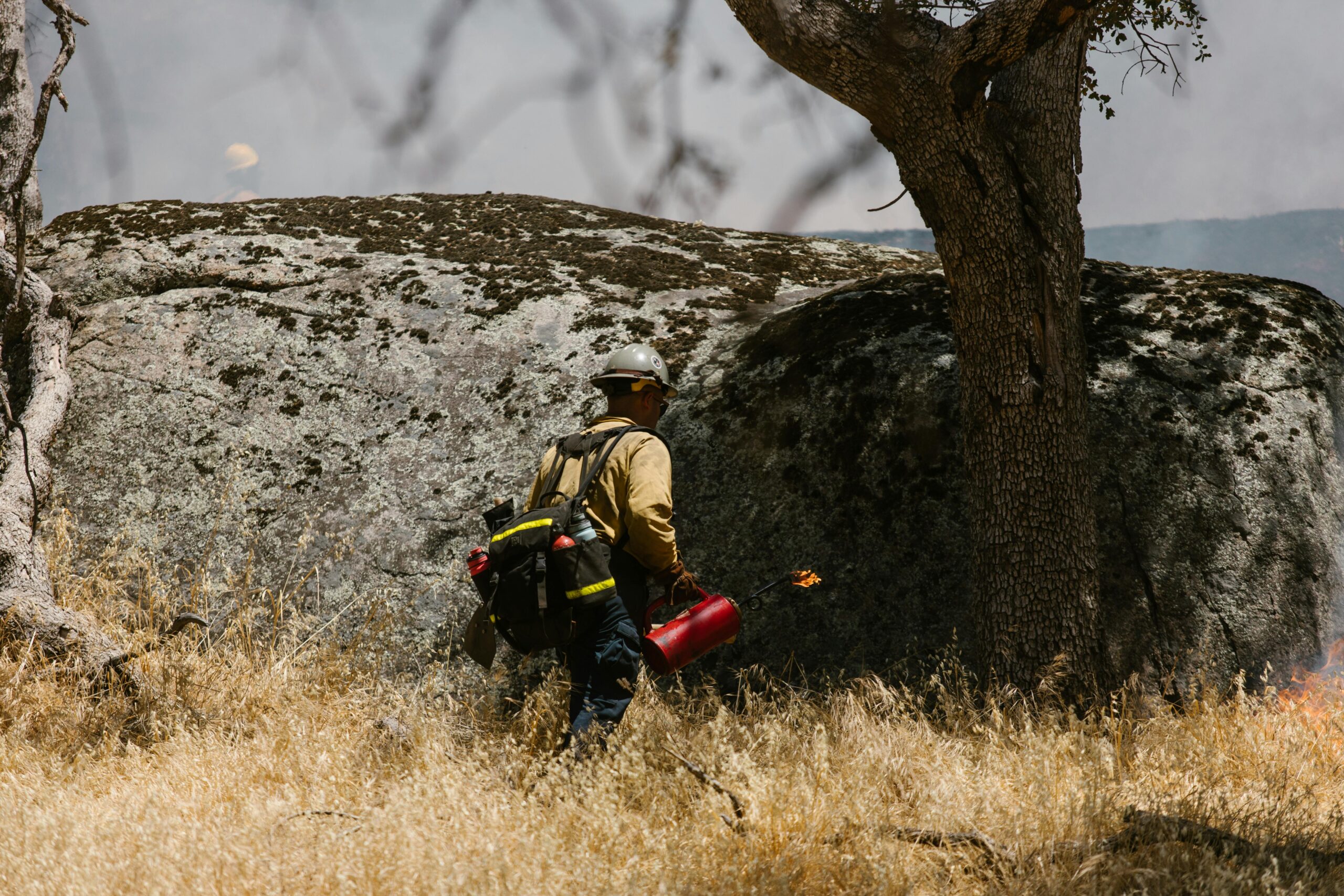
Before diving into vegetation corridors, it’s essential to grasp how embers behave during wildfire events. Embers are small burning particles that detach from the main fire front and can travel remarkable distances, sometimes exceeding two kilometers ahead of the active flame zone. These airborne threats represent one of the most dangerous aspects of wildfire propagation, responsible for approximately 60% of structure losses in wildfire-prone regions.
The ember landing zone refers to the area where these burning particles eventually descend and potentially ignite new fires. Wind patterns, ember size, atmospheric conditions, and critically—the type of vegetation present—all influence where and how these embers land. Understanding this relationship between plant communities and ember behavior forms the foundation for strategic landscape management.
The Dual Nature of Vegetation Corridors
Vegetation corridors serve multiple ecological functions: they provide wildlife habitat, facilitate species migration, prevent erosion, and maintain biodiversity. However, their relationship with wildfire safety presents a complex paradox. These green pathways can either serve as protective barriers or dangerous conduits for fire spread, depending entirely on their composition, maintenance, and strategic placement.
The concept of “green paths to safety” emerges from thoughtful corridor design that maximizes fire resistance while preserving ecological values. This requires understanding plant flammability, moisture content, growth patterns, and spatial arrangement within the landscape matrix.
High-Risk Vegetation Characteristics 🔥
Certain plant species create particularly hazardous conditions for ember accumulation and ignition. Conifers with their resinous needles, eucalyptus trees that shed bark in strips, and plants with high volatile oil content represent elevated fire risks. These species can create what fire scientists call “ladder fuels”—vegetation layers that allow ground fires to climb into tree canopies, generating massive ember showers.
Dense, continuous vegetation without adequate spacing enables ember bridging, where ignition quickly spreads from one plant to adjacent vegetation. This continuous fuel bed essentially negates any protective benefit the corridor might otherwise provide.
Fire-Resistant Corridor Design Elements
Effective vegetation corridors that minimize ember landing hazards incorporate several key design principles. Spacing between plants prevents continuous fuel beds, while selecting low-flammability species reduces ignition probability. Deciduous trees with high moisture content, succulents, and plants with low volatile compounds form the backbone of safer corridor plantings.
Ground-level vegetation management proves equally important. Removing dead plant material, maintaining green groundcover, and eliminating fine fuels reduce the likelihood that landed embers will find receptive ignition sites. Regular maintenance schedules ensure these protective characteristics persist over time.
Scientific Evidence: What Research Reveals
Multiple studies from fire-prone regions worldwide have examined vegetation corridor impacts on ember behavior and fire spread. Research from Australia’s bushfire zones demonstrates that well-designed green corridors can reduce ember landing densities by up to 40% compared to poorly managed vegetation strips.
California wildfire studies reveal that strategic corridor placement perpendicular to prevailing wind directions during fire season can deflect ember trajectories, redirecting them away from critical infrastructure and populated areas. The effectiveness depends heavily on corridor width, with minimum widths of 30 meters showing measurable protective benefits.
European research adds another dimension, showing that vegetation corridors with mixed species composition and varied canopy heights create turbulent airflow patterns that cause embers to drop prematurely, often within the corridor itself rather than reaching vulnerable areas beyond.
🌳 Strategic Corridor Placement for Maximum Protection
Location determines whether a vegetation corridor becomes an asset or liability in wildfire scenarios. Corridors positioned between wildland areas and human developments serve as potential defensive spaces when properly designed. These transitional zones require meticulous plant selection and maintenance protocols.
Topography significantly influences corridor effectiveness. Embers travel farther when moving upslope due to fire behavior dynamics and convective heating. Therefore, corridors on slopes facing potential fire sources require extra attention to low-flammability species and wider protective buffers.
Urban-Wildland Interface Considerations
The urban-wildland interface represents the most critical area for vegetation corridor management. These boundary zones experience the highest structure loss rates during wildfires, making corridor design absolutely essential for community safety. Green corridors in these areas must balance aesthetic expectations, ecological functions, and fire safety requirements.
Multi-functional corridor design incorporates recreational pathways, stormwater management, and fire breaks simultaneously. This integrated approach maximizes community benefits while maintaining safety standards. Strategic irrigation within corridors maintains plant moisture levels, further reducing flammability during critical fire weather periods.
Species Selection: Building Resilient Green Barriers
Choosing appropriate plant species represents the single most important decision in creating vegetation corridors that reduce ember landing hazards. Fire-resistant plants share common characteristics: high moisture content, low volatile oils, minimal dead material retention, and dense leaf structures that resist combustion.
Native species adapted to local conditions typically require less supplemental water and maintenance while providing ecological benefits. However, nativity alone doesn’t guarantee fire resistance. Some native plants evolved with fire as part of their reproduction strategy and actually promote burning.
Recommended Plant Categories for Safer Corridors
- Deciduous hardwood trees: Maple, oak, birch, and alder species with high moisture content and minimal resin
- Succulent groundcovers: Sedum varieties, ice plants, and other fleshy plants with high water content
- Fire-retardant shrubs: Rhododendron, camellia, and other broad-leafed evergreens with dense foliage
- Low-growing perennials: Herbaceous plants that maintain green growth during fire season
- Nitrogen-fixing plants: Certain species that improve soil without creating excessive flammable biomass
Maintenance Protocols That Make the Difference
Even perfectly designed vegetation corridors become fire hazards without consistent maintenance. Seasonal management activities directly impact ember landing zone safety. Spring cleanup removes accumulated dead material before fire season intensifies. Summer irrigation maintains plant moisture levels when natural rainfall decreases. Fall pruning eliminates excessive growth that could create fuel ladders. Winter planning prepares for the upcoming fire season.
Professional assessment every 2-3 years ensures corridor integrity and identifies necessary modifications. Fire behavior changes as plants mature, requiring adaptive management strategies that respond to evolving conditions.
Community Engagement and Shared Responsibility 🤝
Vegetation corridors often span multiple properties and jurisdictions, requiring coordinated management approaches. Successful programs engage property owners, local governments, and land management agencies in shared maintenance responsibilities. Educational initiatives help stakeholders understand how their individual actions contribute to collective safety.
Volunteer programs can supplement professional maintenance while building community awareness and investment in corridor health. Regular communication about fire risk and vegetation management maintains engagement during low-fire-activity periods when complacency might otherwise develop.
Economic Considerations and Cost-Benefit Analysis
Implementing and maintaining effective vegetation corridors requires financial investment, raising legitimate questions about cost-effectiveness compared to other fire mitigation strategies. Initial establishment costs vary widely depending on site conditions, existing vegetation, and desired corridor characteristics, typically ranging from $15,000 to $50,000 per hectare.
Annual maintenance costs represent ongoing commitments, generally 10-15% of establishment expenses. However, these investments deliver multiple returns beyond fire safety: enhanced property values, improved air quality, recreational opportunities, biodiversity conservation, and reduced erosion.
When compared to structure losses during wildfire events—often millions of dollars in single incidents—corridor investment demonstrates clear economic logic. Insurance industry data increasingly recognizes this relationship, with some providers offering premium reductions for properties protected by well-maintained vegetation corridors.
🛰️ Technology and Monitoring Innovations
Modern technology enhances vegetation corridor effectiveness through improved monitoring and management. Satellite imagery and drone surveillance identify corridor sections requiring attention before conditions become hazardous. Thermal imaging detects moisture stress in plants, enabling targeted irrigation that maintains fire resistance while conserving water resources.
Geographic Information Systems (GIS) model ember trajectories based on topography, vegetation characteristics, and weather patterns, allowing predictive corridor placement that addresses specific site vulnerabilities. Mobile applications can help property owners track maintenance schedules and receive alerts during elevated fire danger periods.
Sensor networks within corridors monitor real-time conditions including humidity, temperature, and wind patterns. This data feeds into fire behavior prediction models that inform evacuation decisions and firefighting resource deployment during active incidents.
Climate Change: Adapting Corridor Strategies for the Future
Climate change fundamentally alters wildfire dynamics, requiring adaptive vegetation corridor strategies. Extended fire seasons, increased drought frequency, and shifting plant hardiness zones all impact corridor design and management decisions. Species selection must anticipate future conditions rather than relying solely on historical patterns.
Longer dry periods demand more drought-tolerant species selections that maintain fire resistance without extensive irrigation. However, drought tolerance alone doesn’t ensure fire resistance—careful species evaluation prevents selecting plants that survive dry conditions by reducing moisture content, thereby increasing flammability.
Building Resilience Into Corridor Design
Future-focused corridors incorporate climate resilience through diverse species portfolios that maintain function even if individual species fail under changing conditions. This diversity approach hedges against uncertainty while providing broader ecological benefits. Genetic diversity within species selections further enhances adaptive capacity.
Monitoring climate indicators and adjusting management practices accordingly ensures corridors continue protecting communities as conditions evolve. Flexibility in design and willingness to modify approaches based on emerging science characterize successful long-term corridor programs.
Policy Frameworks Supporting Effective Implementation 📋
Successful vegetation corridor programs require supportive policy environments that encourage proper design and maintenance while providing enforcement mechanisms for minimum safety standards. Regulatory approaches vary from voluntary guidelines to mandatory requirements, with effectiveness depending on local context and stakeholder engagement.
Incentive programs accelerate adoption by offsetting establishment and maintenance costs. Tax credits, grants, and technical assistance programs reduce financial barriers while building capacity for proper corridor management. Recognition programs highlighting exemplary corridor projects create positive reinforcement and community models.
Building codes and development regulations increasingly incorporate vegetation corridor requirements, ensuring new construction includes appropriate buffers and fire-resistant landscaping. Retrofitting existing developments presents greater challenges but remains essential for comprehensive community protection.
Integrating Traditional Ecological Knowledge
Indigenous communities worldwide possess generations of fire management wisdom, including vegetation manipulation strategies that reduce wildfire hazards while maintaining ecosystem health. Cultural burning practices created landscape mosaics with varied vegetation structures and fuel loads, preventing catastrophic fires while supporting biodiversity.
Modern corridor design benefits from integrating this traditional ecological knowledge with contemporary fire science. Collaborative approaches that respect indigenous land management rights while applying proven techniques offer promising pathways forward, particularly on lands with complex ownership and jurisdiction patterns.
🌱 Transforming Landscapes Into Living Safety Networks
Vegetation corridors represent far more than simple firebreaks or decorative landscaping. When thoughtfully designed, strategically placed, and consistently maintained, they become multifunctional landscape elements that simultaneously enhance safety, ecological integrity, and community livability. The impact on ember landing zones depends entirely on understanding fire behavior principles and translating that knowledge into practical management actions.
Success requires commitment beyond initial installation—ongoing maintenance, adaptive management, and community engagement sustain protective benefits over decades. As wildfire risks intensify globally, vegetation corridors offer scalable solutions applicable across diverse landscapes and community types.
The green paths to safety emerge not from any single corridor but from interconnected networks of well-managed vegetation that collectively reduce ember spread and create defendable spaces. This landscape-level approach recognizes that fire protection succeeds through coordinated action rather than isolated interventions. Every properly maintained corridor contributes to community resilience, demonstrating that ecological health and human safety advance together rather than in opposition.
Investment in vegetation corridors today builds lasting protection for future generations while delivering immediate co-benefits that enhance quality of life. As climate change intensifies fire behavior and extends fire seasons, these green corridors become increasingly essential infrastructure—living systems that adapt, grow stronger, and continue protecting communities year after year.